Discover 15 hidden attractions, cool sights, and unusual things to do in Great Smoky Mountains National Park (United States). Don't miss out on these must-see attractions: Oconaluftee, Alum Cave Trail, and Clingmans Dome. Also, be sure to include Chimney Tops in your itinerary.
Below, you can find the list of the most amazing places you should visit in Great Smoky Mountains National Park (Tennessee).
Table of Contents
Oconaluftee
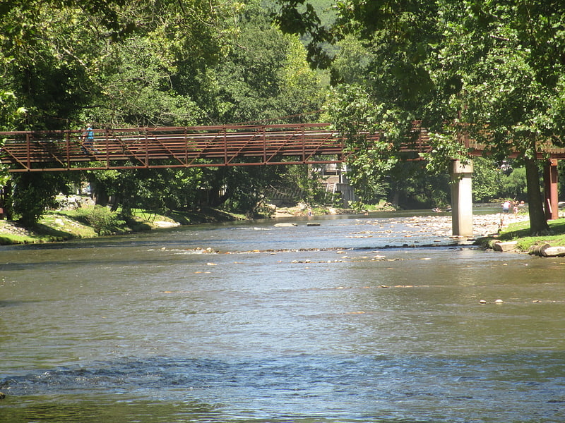
River in North Carolina. Oconaluftee Archeological District is within the eponymous river valley in the Great Smoky Mountains of North Carolina, located in the Southeastern United States. Formerly a historic Cherokee village, followed by an Appalachian community, were located at this site along the Oconaluftee River. Now the site serves as the main entrance to the North Carolina side of the Great Smoky Mountains National Park.
The Oconaluftee area parallels the Oconaluftee River as its basin gradually broadens from Smokemont in the north to the southern tip of the Qualla Boundary. The Qualla Boundary, commonly known as Cherokee, North Carolina, comprises the bulk of a federal trust that serves as a reservation for the federally recognized tribe, Eastern Band of the Cherokee.
The Oconaluftee Visitor Center, Mingus Mill, and the Mountain Farm Museum are all located in this area. Most is part of the Oconaluftee Archaeological District, which was listed on the National Register of Historic Places in 1982.[1]
Alum Cave Trail
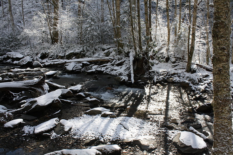
The Alum Cave Trail is an American hiking trail in the Great Smoky Mountains National Park, in Sevier County, Tennessee. The trail ascends Mount Le Conte, the sixth highest mountain east of the Mississippi River, and passes by many notable landmarks, such as Arch Rock, Inspiration Point, the Duckhawk Peaks, and Cliff Top, before merging with Rainbow Falls Trail near the summit.[2]
Address: Newfound Gap Road, Great Smoky Mountains National Park
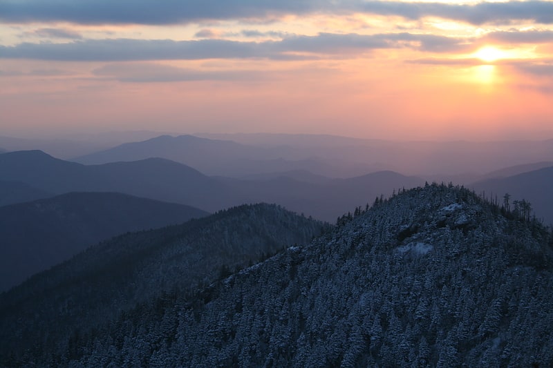
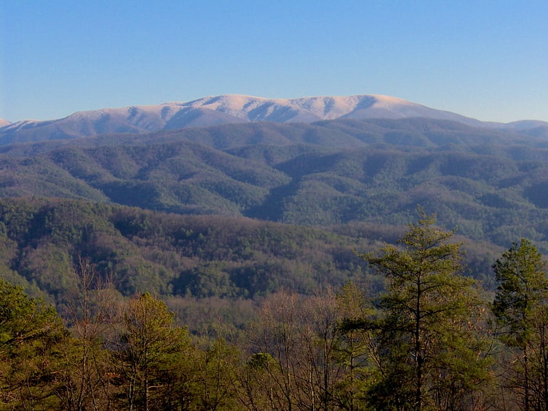
Clingmans Dome
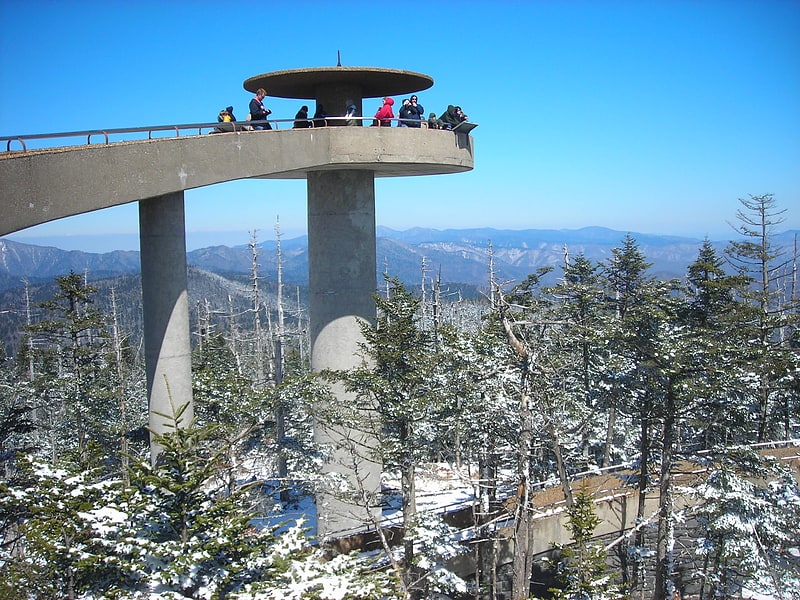
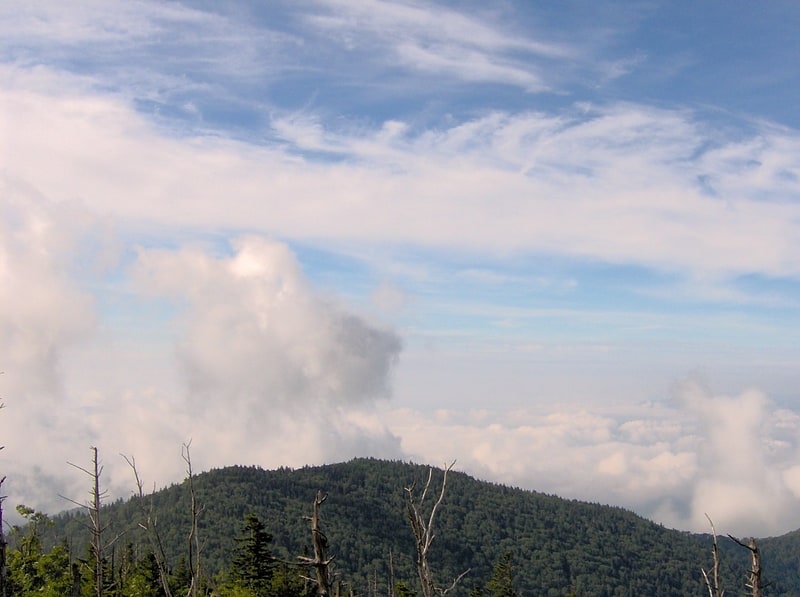
Summit observation tower and paved trail. Clingmans Dome is a mountain in the Great Smoky Mountains of Tennessee and North Carolina in the southeastern United States. Its name in Cherokee is Kuwahi or ᎫᏩᎯ, meaning "mulberry place." At an elevation of 6,643 feet, it is the highest mountain in the Great Smoky Mountains National Park, the highest point in the state of Tennessee, and the highest point along the 2,192-mile Appalachian Trail. It is also the third highest point in mainland Eastern North America, after Mount Mitchell and Mount Craig.[3]
Address: 7 miles off US-441 on the Clingmans Dome Road, Great Smoky Mountains National Park
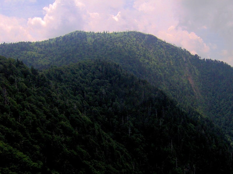
Chimney Tops
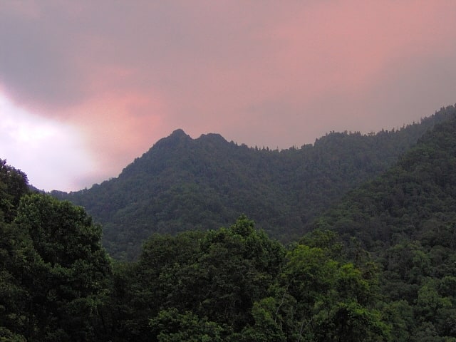
Mountain in Tennessee. Chimney Tops is a mountain in the central Great Smoky Mountains in Tennessee. It is 4,724 feet above sea level. Chimney Tops is a double-capstone knob on the eastern slope of the Sugarland Mountain massif, which stretches north-south across the north-central section of the Smokies. Mount Le Conte resides east of Chimney Tops, and Mt. Mingus southeast of Chimney Tops. Thus, while the view from the summit is 360 degrees, Chimney Tops is practically "walled in" on three sides.[4]
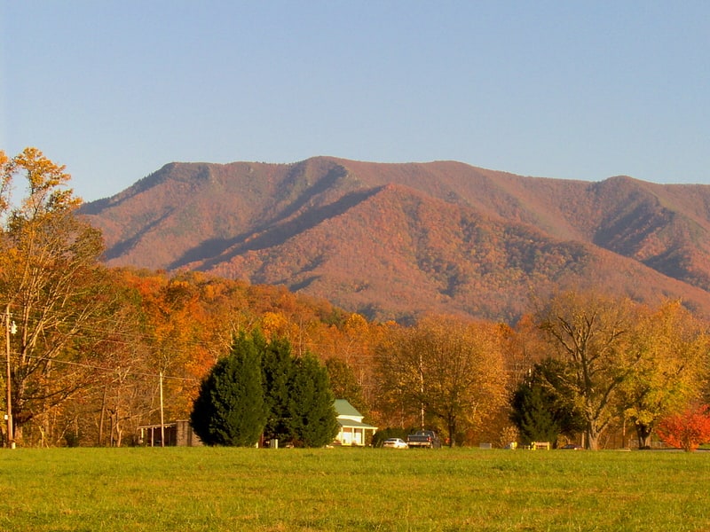
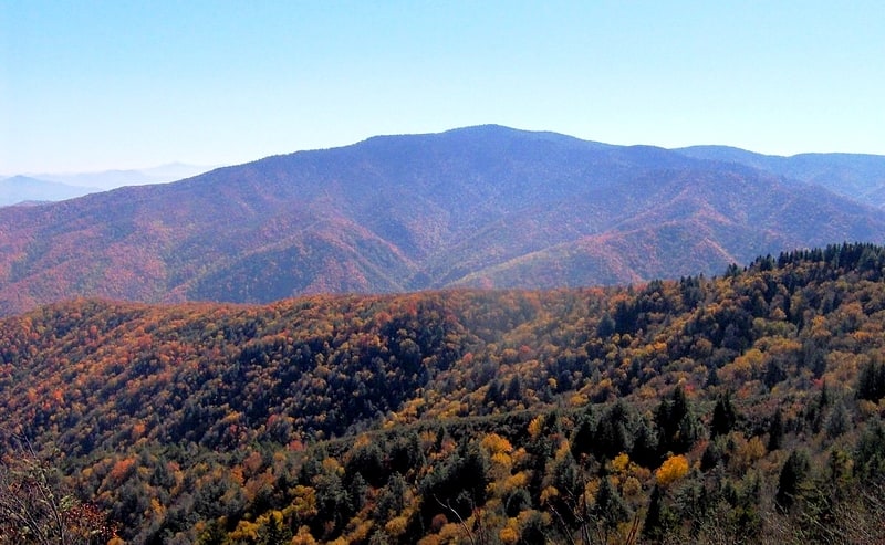
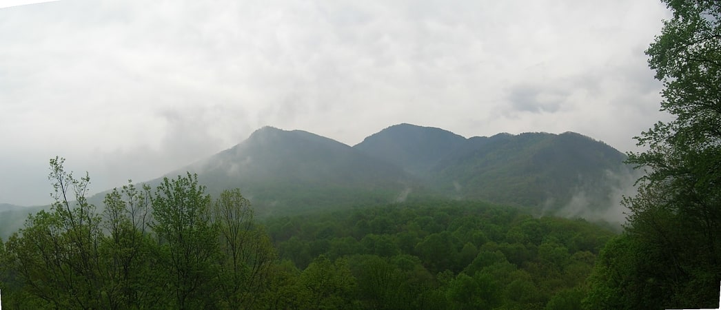
Great Smoky Mountains
Mountain range in the United States of America. The Great Smoky Mountains are a mountain range rising along the Tennessee–North Carolina border in the southeastern United States. They are a subrange of the Appalachian Mountains, and form part of the Blue Ridge Physiographic Province. The range is sometimes called the Smoky Mountains and the name is commonly shortened to the Smokies. The Great Smokies are best known as the home of the Great Smoky Mountains National Park, which protects most of the range. The park was established in 1934, and, with over 11 million visits per year, it is the most visited national park in the United States.
The Great Smokies are part of an International Biosphere Reserve. The range is home to an estimated 187,000 acres (76,000 ha) of old growth forest, constituting the largest such stand east of the Mississippi River. The cove hardwood forests in the range's lower elevations are among the most diverse ecosystems in North America, and the Southern Appalachian spruce-fir forest that coats the range's upper elevations is the largest of its kind. The Great Smokies are also home to the densest black bear population in the Eastern United States and the most diverse salamander population outside of the tropics.
Along with the Biosphere reserve, the Great Smokies have been designated a UNESCO World Heritage Site. The U.S. National Park Service preserves and maintains 78 structures within the national park that were once part of the numerous small Appalachian communities scattered throughout the range's river valleys and coves. The park contains five historic districts and nine individual listings on the National Register of Historic Places.
The name "Smoky" comes from the natural fog that often hangs over the range and presents as large smoke plumes from a distance. This fog is caused by the vegetation emitting volatile organic compounds, chemicals that have a high vapor pressure and easily form vapors at normal temperature and pressure.[5]
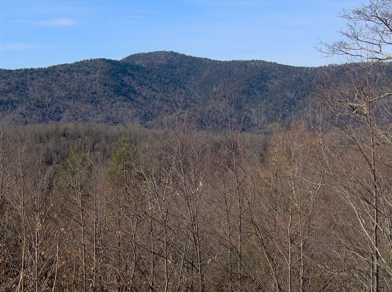
Mount Cammerer
Mountain in North Carolina. Mount Cammerer is a mountain on the northeastern fringe of the Great Smoky Mountains, in the Southeastern United States. The mountain is situated on the state line between Cocke County, Tennessee and Haywood County, North Carolina. The Appalachian Trail traverses Cammerer's south slope and a restored fire lookout at the summit offers panoramic views of the eastern Smokies, Cocke County, and the Blue Ridge Mountains.
Although a narrow ridge connects Mt. Cammerer to a nearby higher knob, leaving Cammerer with a very low topographic prominence, the mountain is clearly visible not only from the surrounding mountains, but from various points in the town of Cosby and along I-40 as it crosses Cocke County. Mt. Cammerer is a popular hiking destination, especially in Autumn, when the leaves of the trees in the forest around the mountain blaze red, orange and yellow for as far as the eye can see.[6]
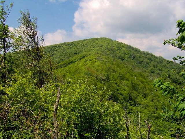
Gregory Bald
Mountain in North Carolina. Gregory Bald is a mountain in the Great Smoky Mountains. It has an elevation of 4,949 feet above sea level. The mountain's majestic summit makes it a popular hiking destination. Another feature that attracts many visitors are the flame azaleas that bloom over the bald every summer. The azaleas reach peak bloom around mid-to-late June.
Gregory Bald is located along the Tennessee-North Carolina border, between Blount County and Swain County. It rises appx. 3,000 feet above its northern base in Cades Cove, and appx. 3,300 feet above its southern base at Fontana Lake. The mountain is located entirely within the Great Smoky Mountains National Park.
Gregory Bald is a type of mountain known as a grassy bald. Unlike most summits in the Appalachians, which are heavily forested or culminate in jagged peaks, grassy balds are covered by a thick layer of wild grass. Trees and other foliage are sparse. How and why a summit develops into a grassy bald is unknown. While there is evidence that Gregory Bald was a natural grassy bald, the National Park Service must currently work to prevent the summit from becoming forested.[7]
Mount Kephart
Mountain in Tennessee. Mount Kephart is a mountain in the central Great Smoky Mountains, located in the Southeastern United States. The Appalachian Trail crosses the mountain's south slope, making it a destination for thru-hikers. The Jumpoff, a 1,000-foot cliff on the northeast side of the mountain, has views of the central and eastern Smokies. A stand of Southern Appalachian spruce-fir forest coats the mountain's upper elevations.
Mount Kephart is the 22nd highest mountain in the eastern U.S. and the 7th-highest mountain in the state of Tennessee. Its topographic prominence is drastically reduced, however, due to the mountain's close proximity to two higher neighbors, Clingmans Dome and Mount Le Conte.
Like much of the Smokies crest, Mount Kephart lies on the Tennessee-North Carolina border, in Sevier County, Tennessee and Swain County, North Carolina. The mountain rises nearly 4,000 feet (1,200 m) above its northern base at Porters Flat, and approximately 3,400 feet (1,000 m) above its southern base along the Oconaluftee headwaters. Newfound Gap, at just over 5,000 feet (1,500 m), divides Mount Kephart from Fork Ridge (Mt. Collins) to the west. The gap is traversed by U.S. Highway 441, the only paved road crossing the Great Smoky Mountains National Park from north to south.[8]
Mount Sterling
Mountain in North Carolina. Mount Sterling is a mountain in the Great Smoky Mountains of Haywood County, North Carolina, located in the southeastern United States. It reaches an elevation of 5,842 feet above sea level. The summit is topped by an abandoned fire tower that gives stunning views of other nearby peaks.
Mount Sterling crowns Mount Sterling Ridge, a 7-mile ridge that gradually descends northward from the flanks of Big Cataloochee Mountain to the Pigeon River Valley. The ridge divides the Cataloochee area to the east from the Big Creek Valley to the west. The communities of Mount Sterling, North Carolina, and Waterville, North Carolina are located in the Pigeon Valley at the ridge's northern extreme. Geologically, Mount Sterling consists mainly of Precambrian metamorphic sandstone of the Ocoee Supergroup, formed nearly a billion years ago from ancient ocean sediments. The summit of Mount Sterling is surrounded by a stand of Southern Appalachian spruce-fir forest.[9]
Silers Bald
Mountain in Tennessee. Silers Bald is a mountain in the western Great Smoky Mountains, located in the Southeastern United States. Its proximity to Clingmans Dome and its location along the Appalachian Trail make it a popular hiking destination.
Silers Bald is located on the crest of the Smokies with Thunderhead Mountain to the west and Clingmans Dome to the east. The Tennessee-North Carolina state line crosses the summit, with the mountain split evenly between Sevier County, Tennessee to the north and Swain County, North Carolina to the south. Silers Bald rises appx. 2,500 feet (760 m) above its northern base near Fish Camp Prong (of Little River), and appx. 3,000 feet (910 m) above its southern base near Forney Creek.
While Silers Bald was a grassy bald for most of the 19th and early-20th centuries, it was probably a wooded peak before the arrival of European settlers. For this reason, the park service does not maintain the bald atop the mountain (the Great Smoky Mountains National Park currently maintains only two grassy balds— Gregory Bald and Andrews Bald). A narrow corridor for the Appalachian Trail, which crosses the summit, is kept clear for thru-hikers. There is still a small bald area at the summit, approximately 30 feet (9.1 m) in diameter, where the Appalachian Trail makes a 90-degree turn. Several grassy meadows remain on the mountain's western slope.[10]
Mount Collins
Mountain in North Carolina. Mount Collins is a mountain in the Great Smoky Mountains, located in the Southeastern United States. It has an elevation of 6,188 feet above sea level. Located along the Appalachian Trail between Clingmans Dome and Newfound Gap, the mountain is a popular destination for thru-hikers. A backcountry shelter and a major trail junction are located along the mountain's northeastern slope. The mountain's summit is located amidst the Southern Appalachian spruce-fir forest that covers much of the upper elevations in the central Smokies.
Like most of the Smokies crest, Mount Collins is situated along the Tennessee-North Carolina border, with Sevier County to the north and Swain County to the south. The mountain rises approximately 4,000 feet (1,200 m) above its southeastern base near Bryson City and just over 3,000 feet (910 m) above its northwestern base near Meigs Post Prong. The mountain is the 25th-highest mountain in the Eastern United States, the 7th-highest in Tennessee, and the 10th-highest in the Great Smoky Mountains National Park.
The Sugarland Mountain massif— which rises in the Sugarlands and stretches nearly 10 miles (16 km) across the north-central section of the park— intersects the Smokies crest at the summit of Mount Collins. Two major watersheds— Little River and the West Fork of the Little Pigeon River— have their sources high on the mountain's northern slopes. The former flows down to Townsend and drains the northwestern Smokies before emptying into the Little Tennessee River. The latter drains the north-central section of the park, flowing through the Sugarlands, Gatlinburg, Pigeon Forge, and Sevierville en route to the French Broad River.
Mount Collins is named after Robert Collins, an Oconaluftee resident who guided Arnold Guyot across the crest of the Smokies in the late 1850s. In 1859, Guyot correctly measured the mountain's summit at 6,188 feet (1,886 m). While originally named "Mount Collins", the mountain was known as "Meigs Post" throughout the late-19th century and early-20th century after a station constructed by Return Meigs near its summit. In 1931, Horace Kephart requested the mountain be named for him, but due to protests from Tennesseans (who favored their statesman Robert Collins over the North Carolinian Kephart), he settled on the mountain that now bears his name several miles to the east.[11]
Charlies Bunion
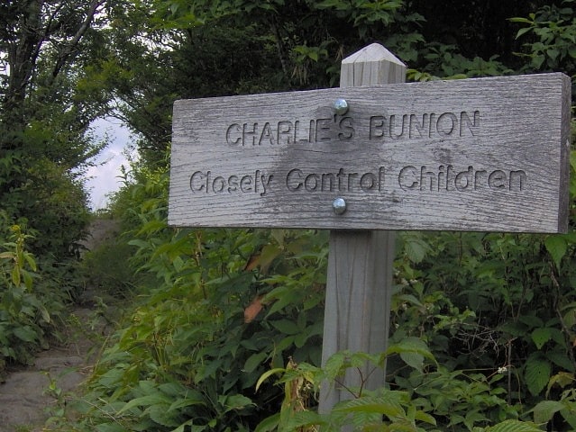
Mountain in Tennessee. Charlies Bunion is a mountain in the Great Smoky Mountains of the Southeastern United States, characterized by a large boulder-like protrusion just below the summit on its otherwise-sheer northern face. The mountain is a rare instance of a bare-rock summit in the Smokies.
Charlies Bunion rises to an elevation of 5,564 feet (1,696 m) above sea level, and is situated along the state line between Sevier County, Tennessee and Swain County, North Carolina. The Appalachian Trail crosses the mountain's northern slope some four miles (6 km) east of Newfound Gap, allowing easy access to dayhikers and rock climbers.[12]
Mayna Treanor Avent Studio
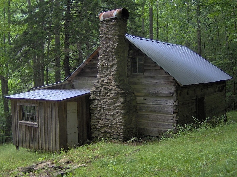
Historical landmark in Sevier County, Tennessee. Avent Cabin, in the Great Smoky Mountains National Park near Elkmont, Tennessee, United States, is an early Appalachian mountain cabin that was used as a summer studio and retreat by noted artist Mayna Treanor Avent. It is listed on the National Register of Historic Places.[13]
Mount Le Conte
Mountain in Tennessee. Mount Le Conte is a mountain located within the Great Smoky Mountains National Park in Sevier County, Tennessee. At 6,593 ft it is the third highest peak in the national park, behind Clingmans Dome and Mount Guyot. It is also the highest peak that is completely within Tennessee. From its immediate base to its summit, Mount Le Conte is the mountain with the highest relief east of the Rocky Mountains, rising 5,301 feet from its base, near Gatlinburg, Tennessee.
There are four subpeaks above 6,000 feet (1,800 m) on the mountain (referred to as the LeConte massif): West Point (6,344 feet (1,934 m)), High Top (6,593 feet (2,010 m)), Cliff Tops (6,555 feet (1,998 m)), and Myrtle Point (6,200 feet (1,900 m)). In addition, Balsam Point, with an elevation above 5,840 feet (1,780 m), serves as the dramatic west end of the massif.
Mount Le Conte has the highest inn that provides lodging for visitors in the Eastern United States.[14]
Andrews Bald
Mountain in North Carolina. Andrews Bald is a mountain in the Great Smoky Mountains, located in the Southeastern United States. It has an elevation of 5,920 feet above sea level, making it the highest grassy bald in the Great Smoky Mountains National Park. The mountain is one of two grassy balds maintained in the range by the park service. The other is Gregory Bald, in the western Smokies.
Andrews Bald is a double peak situated along Forney Ridge, just south of Clingmans Dome. The mountain appears in the Clingmans Dome quad on USGS topographical maps. Andrews Bald is the 62nd-highest mountain in North Carolina, and is located entirely within Swain County.
Unlike Gregory Bald, the bald area of Andrews doesn't cover the summit, but spreads out around the south slope. How and why grassy balds form is a mystery. While cattle grazing maintained the balds throughout the 19th-century, the forest slowly started reclaiming them after the formation of the national park in the 1930s. In the early 1980s, the park service polled park visitors regarding the state of the grassy balds, and the response was overwhelmingly in favor of maintaining the balds atop Gregory and Andrews.
Andrews Bald is probably named after Andres Thompson, an early settler who used the mountain for hunting. A cabin once stood on the southwest slope, near the tip of the present bald area. Herders' shacks were not uncommon in the high-elevation grazing areas of southern Appalachia during the late 19th and early 20th centuries, so the cabin may have been a seasonal residence.
The Forney Ridge Trail crosses Andrews Bald, passing to within a few feet of the summit, and traverses the entire bald area en route to Springhouse Branch. The trail intersects the Appalachian Trail on the slopes of Clingmans Dome, and can be accessed from the Forney Ridge parking lot. The bald area is just under two miles from the parking lot.[15]