Discover 5 hidden attractions, cool sights, and unusual things to do in Cairo (United States). Don't miss out on these must-see attractions: Magnolia Manor, Old Custom House, and Fort Defiance. Also, be sure to include Cairo Historic District in your itinerary.
Below, you can find the list of the most amazing places you should visit in Cairo (Illinois).
Table of Contents
Magnolia Manor
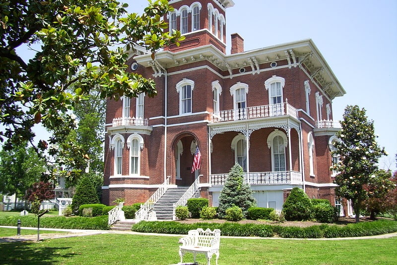
Museum in Cairo, Illinois. Magnolia Manor is a postbellum manor located in Cairo, Illinois, located in Alexander County. It has been listed on the National Register of Historic Places since December 17, 1969.
The house is operated as a Victorian period historic house museum by the Cairo Historical Association.[1]
Address: 2700 Washington Ave, 62914-1458 Cairo
Old Custom House
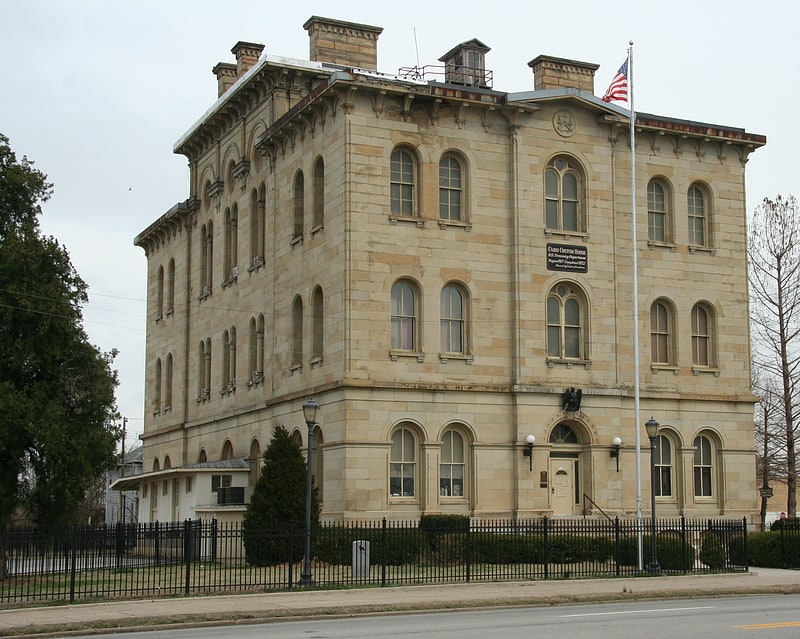
Building in Cairo, Illinois. The Old Custom House is a historic government building in downtown Cairo, Illinois. Built from 1869 to 1872, the building served as a customs house, post office, and courthouse. Alfred B. Mullett, the U.S. Supervising Architect at the time, designed the building in the Italianate style, a rarity among federal buildings; his design features a bracketed cornice and rounded windows. When Cairo built a new post office in 1942, the building became the town's police station. The building is one of the few surviving U.S. custom houses and one of the largest federal buildings of its era in the Mid-Mississippi Valley region.
The custom house was added to the National Register of Historic Places on July 24, 1973. It now serves as a history museum.
In celebration of the 2018 Illinois Bicentennial, Cairo Custom House was selected as one of the Illinois 200 Great Places by the American Institute of Architects Illinois component (AIA Illinois).[2]
Address: 1400 Washington Ave, 62914-1870 Cairo
Fort Defiance
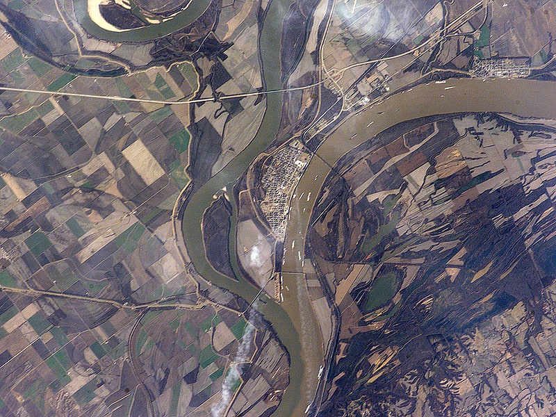
State park in Cairo, Illinois. Fort Defiance, known as Camp Defiance during the American Civil War, is a former military fortification located at the confluence of the Ohio and Mississippi rivers in the city limits of Cairo, in Alexander County, Illinois. The strategic significance of the site has been known since prehistoric times with archaeological evidence of warfare dating to the Mississippian era. It is the southernmost park in the state of Illinois. At 279 feet in elevation, Fort Defiance Point is also Illinois' lowest point.
Formerly a state park, it has been owned and maintained by the city of Cairo since the 1990s. The Illinois Department of Natural Resources assumed control of Fort Defiance on July 31, 2014, with the goal of returning it to state park status. The park is a satellite of Horseshoe Lake State Fish and Wildlife Area.[3]
Cairo Historic District
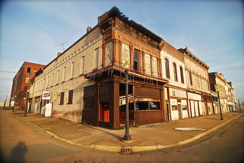
Historical place in Cairo, Illinois. The Cairo Historic District is a historic district encompassing a large section of Cairo, Illinois. The district is roughly bounded by Park, 33rd, Sycamore, 21st, Cedar, and 4th Streets and the Ohio River; it includes most areas of Cairo developed by 1890, save for two sections which are almost entirely renovated or deteriorated. The district includes roughly 980 buildings, including both commercial and residential areas. Cairo served as a transportation and trade center in the 1800s due to its location at the confluence of the Ohio and Mississippi Rivers and its status as the southern terminus of the Illinois Central Railroad. However, the city suffered severe population decline and urban decay in the 20th century, and even by the 1970s, parts of the district were described as "beginning to assume the appearance of a ghost town".
The district was added to the National Register of Historic Places on January 26, 1979.[4]
Upper Mississippi River

The Upper Mississippi River is the portion of the Mississippi River upstream of St. Louis, Missouri, United States, at the confluence of its main tributary, the Missouri River.[5]