Discover 8 hidden attractions, cool sights, and unusual things to do in Big Sur (United States). Don't miss out on these must-see attractions: Bixby Creek Bridge, McWay Falls, and Point Sur Lighthouse. Also, be sure to include Pfeiffer Beach in your itinerary.
Below, you can find the list of the most amazing places you should visit in Big Sur (California).
Table of Contents
Bixby Creek Bridge
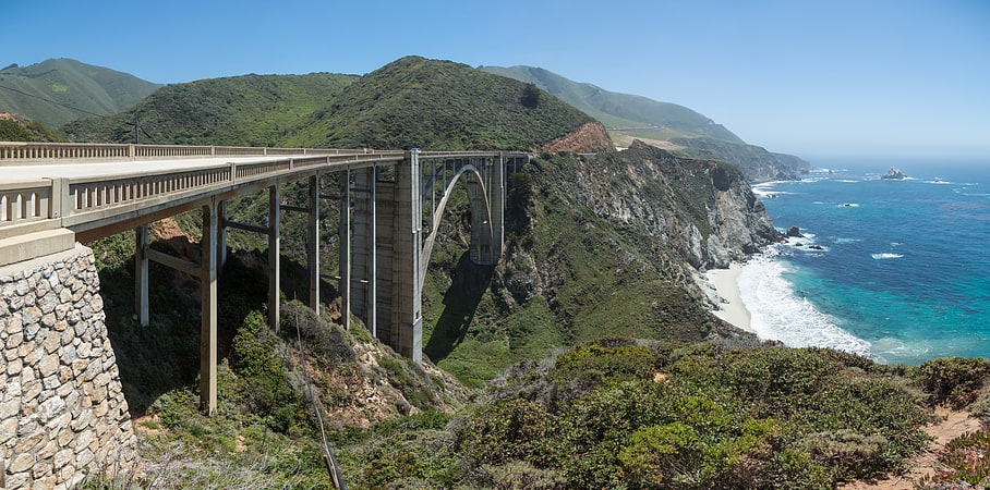
Open-spandrel arch bridge in Monterey County, California. Bixby Creek Bridge, also known as Bixby Canyon Bridge, on the Big Sur coast of California, is one of the most photographed bridges in California due to its aesthetic design, "graceful architecture and magnificent setting". It is a reinforced concrete open-spandrel arch bridge. The bridge is 120 miles south of San Francisco and 13 miles south of Carmel in Monterey County along State Route 1.
Before the opening of the bridge in 1932, residents of the Big Sur area were virtually cut off during winter due to blockages on the often impassable Old Coast Road, which led 11 miles (18 km) inland. The bridge was built under budget for $199,861 (equivalent to $3.16 million in 2020 dollars) and, at 360 feet (110 m), was the longest concrete arch span in the California State Highway System. When it was completed, it was the highest single-span arch bridge in the world, and it remains one of the tallest.
The land north and south of the bridge was privately owned until 1988 and 2001. A logging company obtained approval to harvest redwood on the former Bixby Ranch to the north in 1986, and in 2000 a developer obtained approval to subdivide the former Brazil Ranch to the south. Local residents and conservationists fought their plans, and both pieces of land were eventually acquired by local and federal government agencies. A $20 million seismic retrofit was completed in 1996, although its 24-foot (7.3 m) width does not meet modern standards requiring bridges to be 32 feet (9.8 m) wide.[1]
Address: 27602 Highway 1, 93940 Big Sur
McWay Falls
80-foot waterfall onto a small beach. McWay Falls is an 80-foot-tall waterfall on the coast of Big Sur in central California that flows year-round from McWay Creek in Julia Pfeiffer Burns State Park, about 37 miles south of Carmel, into the Pacific Ocean. During high tide, it is a tidefall, a waterfall that empties directly into the ocean. The only other tidefall in California is Alamere Falls.[2]
Point Sur Lighthouse
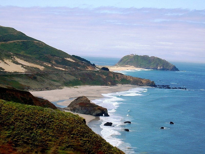
Lighthouse in Monterey County, California. Point Sur Lighthouse is a lightstation at Point Sur 24.6 miles south of Monterey, California at the peak of the {{convert|361|ft|adj=on} rock at the head of the point. It was established in 1889 and is part of Point Sur State Historic Park. The light house is 40 feet tall and 270 feet above sea level. As of 2016, and for the foreseeable future the light is still in operation as an essential aid to navigation. Point Sur is the only complete turn-of-the-20th-century lightstation open to the public in California. Three-hour walking tours guided by volunteers are available on Wednesdays and weekends throughout the year.[3]
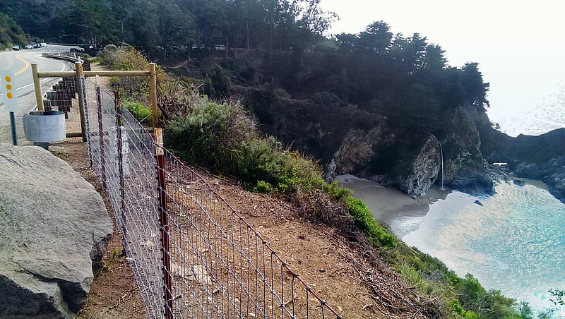
Pfeiffer Beach
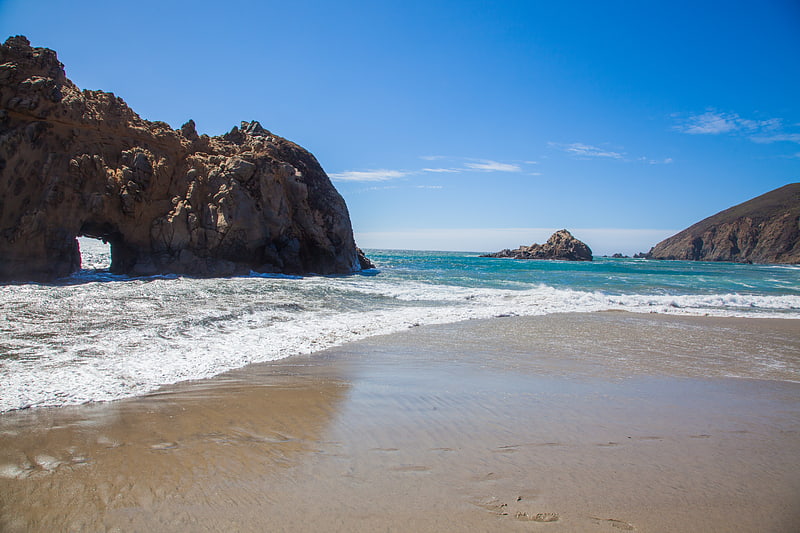
Park in Monterey County, California. Pfeiffer Beach is located in the Big Sur region of California. It is one of the most popular beaches on the Central Coast and is well known for Keyhole Rock, a popular photography subject. On a limited number of days in December and January each year, photographers crowd the beach to obtain pictures of the setting sun visible through the arch. Due to the steep terrain prevalent along the Big Sur coast, it is one of the few ocean access points within Big Sur[4]
Address: Sycamore Canyon Road, 93920 Big Sur
Point Lobos
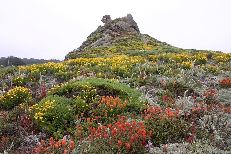
State park in Monterey County, California. Point Lobos and the Point Lobos State Natural Reserve is the "crown jewel" of California's 280 state parks. Australian-born landscape artist Francis McComas described the point as the "greatest meeting of land and water in the world." Adjoining Point Lobos is "one of the richest marine habitats in California." The ocean habitat is protected by two marine protected areas, the Point Lobos State Marine Reserve and Point Lobos State Marine Conservation Area. The sea near Point Lobos is considered one of the best locations for scuba diving on the Monterey Peninsula and along the California coast.
Point Lobos is just south of Carmel-by-the-Sea, California, United States, and at the north end of the Big Sur coast of the Pacific Ocean. Point Lobos features a number of hiking trails, many alongside the ocean, and a smaller number of beaches. The historic Whalers Cabin, built by Chinese fishermen and later used by Japanese and Portuguese fishermen, is now a museum.
Point Lobos nearly became the site of a town. In 1896, the Carmelo Land and Coal Company subdivided the land into 1,000 lots and named the new town "Carmelito". Engineer Alexander Allan purchased the land and over many years bought back the lots that had been sold and erased the subdivision from the county records. As of 2017, more than one million annual visitors from around the world visited Point Lobos, which is restricted by only 150 on-site parking spaces. The majority of visitors must park on the shoulder of Highway 1 and walk into the reserve. Visitor levels are exceeding the capacity of the Reserve and the state is considering requiring reservations during peak hours.[5]
Hearst San Simeon State Park
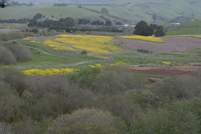
State park in San Luis Obispo County, California. Hearst San Simeon State Park is a state park of California, United States, preserving rocky coast and rare habitats. It is located between Cambria and San Simeon. The 3,409-acre park was first established in 1932. The park includes the Santa Rosa Creek Natural Preserve, the San Simeon Natural Preserve and the Pa-nu Cultural Preserve, which were established in 1990.
A 3.3-mile (5.3 km) trail runs through parts of the San Simeon Natural Preserve and the Washburn Campground. The trail includes scenic overlooks, rest-stop benches and interpretive panels with information on wildlife and habitat. A portion of the trail along the seasonal wetland is wheelchair accessible.
Santa Rosa Creek Preserve is an area that includes valuable riparian forests and coastal wetlands, which provide habitat for endangered tidewater goby.
San Simeon Natural Preserve consists of vast wetlands, riparian zones, and several undisturbed native plant communities, including unique mima mound topography. The Preserve is also the wintering site for monarch butterfly populations.
In 2005 an additional 1,100 acres (445 ha) of coastal lands were added to the state park following an easement agreement and property exchange with the neighboring Hearst Ranch.[6]
Point Sur State Historic Park
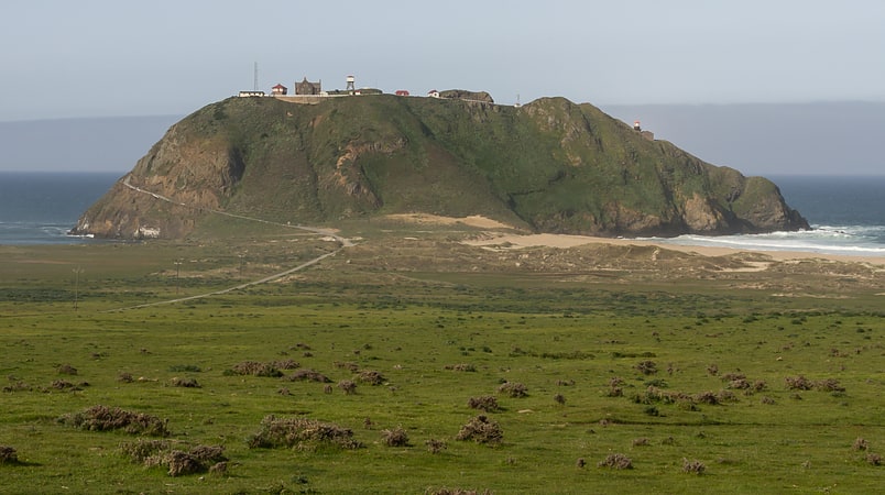
State park in Monterey County, California. Point Sur State Historic Park is a California State Park on the Big Sur coastline of Monterey County, California, United States, 19 miles south of Rio Road in Carmel. The 1889 Point Sur Lighthouse is on the National Register of Historic Places.[7]
Address: Hwy 1, Big Sur
Deetjen's Big Sur Inn
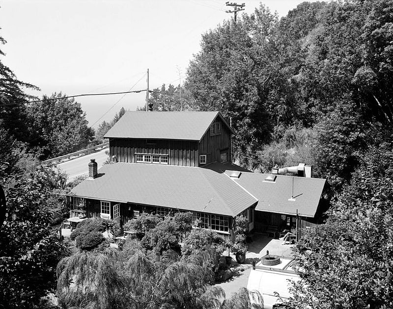
Hotel. Deetjen's Big Sur Inn, a collection of single wall buildings, cabins, and a restaurant in Castro Canyon, was one of the first visitor accommodation to offer overnight lodging and meals to Big Sur, California visitors and travelers after the opening of Highway 1 in 1937. Helmuth Deetjen initially built cottages for others in Carmel, and was attracted to the Big Sur coast that reminded him of Norway. In 1926, he bought 6 acres and began construction of a home. He met Helen Haight and when Highway 1 was completed in 1937, they opened an inn. Helmuth managed the Inn until his death in October 1972, when its operation passed to a non-profit foundation. The Inn was closed for a short time after the Soberanes Fire and subsequent winter floods damaged several structures.[8]