Discover 11 hidden attractions, cool sights, and unusual things to do in Beaverhead–Deerlodge National Forest (United States). Don't miss out on these must-see attractions: Mount Jefferson, Table Mountain, and Black Butte. Also, be sure to include West Peak in your itinerary.
Below, you can find the list of the most amazing places you should visit in Beaverhead–Deerlodge National Forest (Montana).
Table of Contents
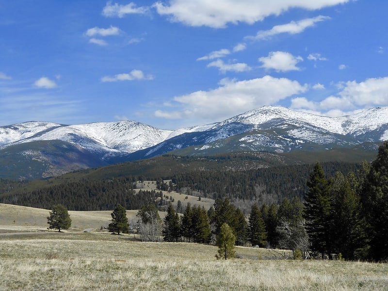
Mount Jefferson
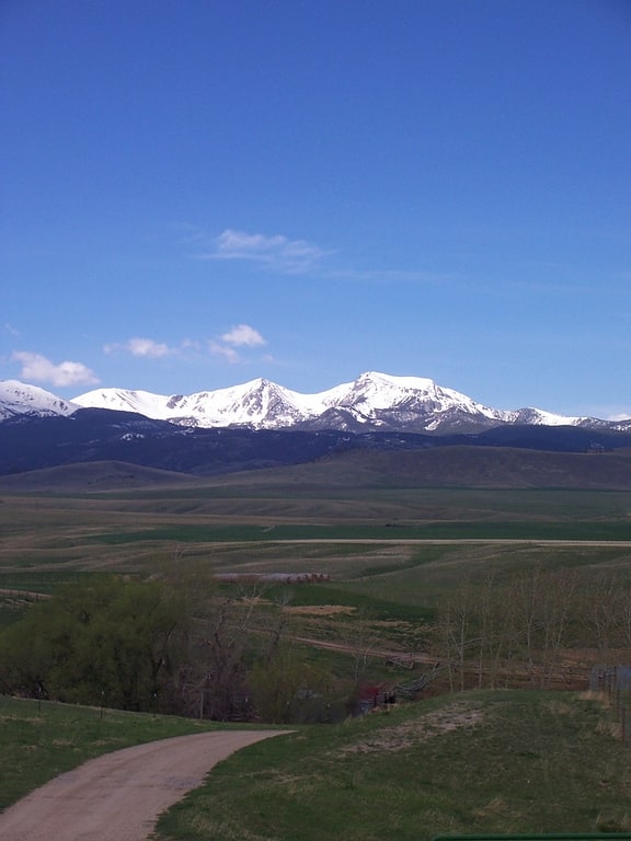
Mountain in Montana. Mount Jefferson is a mountain in the U.S. state of Montana, and is one of the many 10,000+ ft peaks in the Tobacco Root Mountains. The mountain is located in Beaverhead-Deerlodge National Forest. Hollowtop Mountain is an adjacent, taller peak less than.75 miles to the north. Over the years, the two summits have had numerous names and elevations recorded on various maps. According to U.S. Geological Survey topographic maps, Mount Jefferson is 10,513 ft, while Hollowtop Mountain to the north is 10,604 ft.[1]
Table Mountain
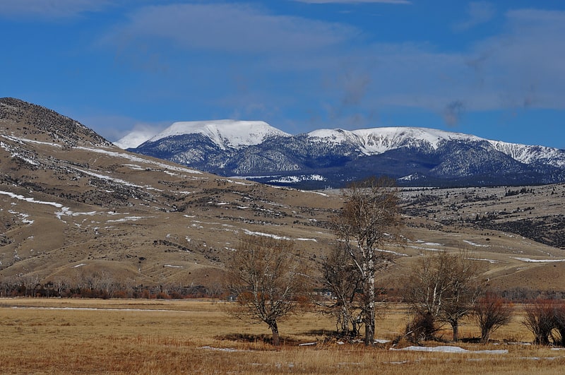
Peak in Montana. Table Mountain, el. 10,213 feet is the highest peak in the Highland Mountains in Madison County, Montana. It is located in Beaverhead-Deerlodge National Forest. Headwaters of Moose Creek, Fish Creek and Hell's Canyon Creek, all significant tributaries of the Jefferson River flow off the face of the mountain.[2]
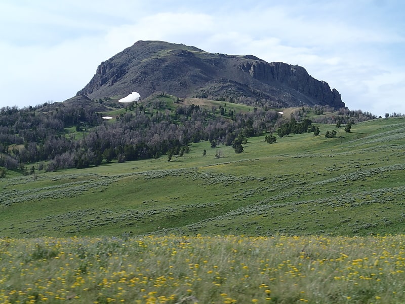
Black Butte
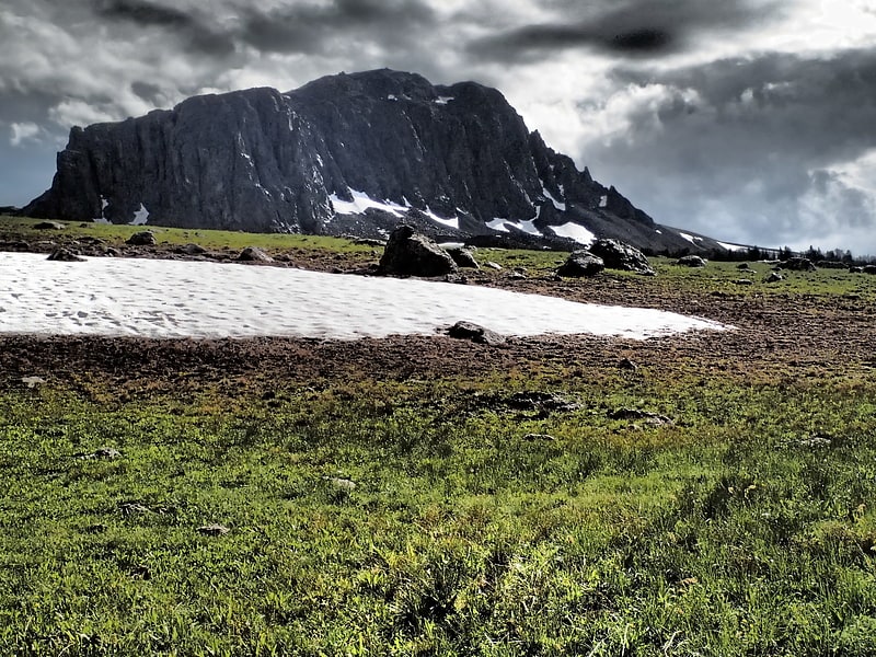
Peak in Montana. Black Butte, el. 10,547 feet is the highest peak in the Gravelly Range in Madison County, Montana. The eastern base of the peak is less than 1 mile from the Beaverhead-Deerlodge National Forest road #290.[3]
West Peak
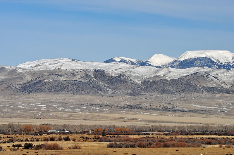
Mountain. West Peak, el. 9,659 feet, is a mountain peak in the Highland Mountains in Madison County, Montana. It rises due west from Table Mountain in the same range. The peak is located in the Deerlodge National Forest. The headwaters of Hell's Canyon Creek, a significant tributary of the Jefferson River flow off the southeast face of the peak.[4]
Fraternity Hall
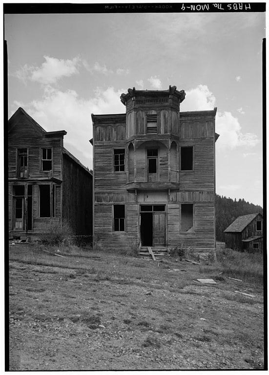
Building in Elkhorn, Montana. Fraternity Hall is a site on the National Register of Historic Places located in Elkhorn, Montana. It was added to the Register on April 3, 1975.
The building was built in the 1890s. It has an ornate, cantilevered balcony and it has a false front with simulated pilasters and arches which "is said to be architecturally unique". Its NRHP nomination asserts that "It is perhaps the most photographed ghost town building in the United States and is featured on the cover of many publications on ghost towns. The Architectural Record also featured Fraternity Hall as number one on a list of 12 structures in the West that should be saved. The first floor of the building was used as a meeting hall, community dance hall, and for theatrical presentations. The second floor served as a lodge meeting hall for such groups as the Masons, Knights of Pythias, IOOF, IOGT, Sons of St. Georges, and the Ancient Order of United Workmen."[5]
Centennial Mountains
The Centennial Mountains are the southernmost sub-range of the Bitterroot Range in the U.S. states of Idaho and Montana. The Centennial Mountains include the Western and Eastern Centennial Mountains. The range extends east from Monida Pass along the Continental Divide to Henrys Fork 48 km NNW of Ashton, Idaho; bounded on the west by Beaver Creek, on the north by Centennial Valley and Henrys Lake Mountains, on the east by Henrys Lake Flat, and on the south by Shotgun Valley and the Snake River Plain. The highest peak in the range is Mount Jefferson.
They are one of only a few ranges within the Rocky Mountains that trend west to east, and the Continental Divide runs along their ridge line.
The Western Centennial Mountains extends west from the Eastern Centennial Mountains along the Continental Divide to Monida Pass, 25 mi NE of Dubois, Idaho; Snake River Plain, on the north by Centennial Valley, and the east by a line connecting Odell Creek and an unnamed tributary, in Montana, to Ching Creek in Idaho.
About 100,000 acres of the Centennials are roadless. This includes National Forest lands, the Bureau of Land Management's Centennial Mountains Primitive Area, a portion of Red Rock Lakes National Wildlife Refuge, state and private land, and part of a USDA Agricultural Research Station for sheep. Around 326 vascular plant species have been identified in the Centennials, an unusual plant diversity for the Yellowstone region. Grizzly bears inhabit the area, as nearly all species indigenous to the Greater Yellowstone Ecosystem are present. The north slope of the Centennials rises abruptly 3,000 feet above the Centennial Valley.[6]
Miners Union Hall
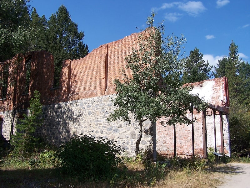
Building in Philipsburg, Montana. Miners Union Hall, located east of Philipsburg, Montana in Deerlodge National Forest, is a historic building built in 1890. Also known as Granite Miners Union Hall, it served as a meeting hall. It was listed on the National Register of Historic Places in 1974.
In its first floor was a pool parlor and a club area; on the second floor was a large dance floor, an auditorium space, and an office and library.[7]
Tobacco Root Mountains
Mountain range in Montana. The Tobacco Root Mountains lie in the northern Rocky Mountains, between the Jefferson and Madison Rivers in southwest Montana. The highest peak is Hollowtop at 10,604 feet. The range contains 43 peaks rising to elevations greater than 10,000 feet.
Much of the central part of the range is within the Beaverhead-Deerlodge National Forest, although many, mostly small patented mining claims exist within the forest boundary. The range saw significant gold mining, especially during the 1880s to 1930s.
The high peaks have been extensively glaciated, and most of the larger stream valleys held valley glaciers during the ice age.[8]
Elkhorn Mountains
Mountain range in Montana. The Elkhorn Mountains are a mountain range in southwestern Montana, part of the Rocky Mountains and are roughly 300,000 acres in size. It is an inactive volcanic mountain range with the highest point being Crow Peak at 9,414 ft, right next to Elkhorn Peak, 9,381 ft. The range is surrounded by the cities of Helena, Montana City, Townsend, Whitehall, and Boulder and is part of the Helena National Forest in Montana's Jefferson County.[9]
Gravelly Range
Range in Montana. The Gravelly Range, highest peak Black Butte, el. 10,542 feet, is a mountain range southwest of Cameron, Montana in Madison County, Montana.
About 310,000 acres total are roadless, separated by roads into nine units, the largest of which is 66,000 acres in size. Nearly all the range is part of the Beaverhead-Deerlodge National Forest. In the northern part of the range is the Bureau of Land Management's Axolotl Lakes Wilderness Study Area, 7,804 acres in size, which is part of a larger roadless area of 47,000 acres. The Axolotl Lakes WSA is home to a unique form of indigenous tiger salamander. This part of the Gravellies is characterized by open foothills rising to mixed coniferous forest interspersed with meadows. Some of the highest-elevation pronghorn habitat in Montana is found here.
On the eastern slope of the Gravellies, Cave Mountain is home to unique undisturbed grasslands and caves that attract spelunkers. The most rugged part of the range is a 52,870-acre roadless area centered on 10,281' Big Horn Mountain, with deep canyons, cliffs, steep benches, and undulating basins.
The largest roadless area in the Gravellies features rolling basins cut by rocky canyons, old Native American campsites along the Gravelly Divide, and westslope cutthroat trout in the remote canyons of the Elk River.
The southeastern part of the range, near the Continental Divide, features a chain of lakes that provide homes to nesting trumpeter swans and bald eagles. Grizzly bears have recently been confirmed to be living in the Gravellies.[10]
Flint Creek Range
Mountain range in Montana. The Flint Creek Range, el. 10,168 feet, is a mountain range northeast of Philipsburg, Montana in Granite County, Montana. The highest point in the range is Mount Powell, at 10,168 ft. in elevation.
About 60,000 acres of the Flints are roadless. From Deer Lodge, Montana, there appears to be a level, barren ridge connecting Mount Powell and Deer Lodge Mountain, el. 9765 ft. However, if one is traveling eastbound on Interstate 90, in the stretch between Drummond and Garrison, Montana, looking up one can see that this ridge is actually a sheer cliff called "The Crater." The Crater is characterized as "iant granite ribs resembling the backbone of a dinosaur" by Cunningham. The Flints have the typical Rocky Mountain fauna, including a few mountain goats. The area is popular for hunting of deer, elk, and blue grouse, but otherwise appears to receive little recreational use. A six-person capacity cabin on Doney Lake is available for rental from the Deer Lodge Ranger District year-round. Dozens of alpine lakes in the range provide good fishing.
The Discovery Ski Area is located in the southwestern part of the Flints, near Georgetown Lake.[11]